Saturday, April 30, 2016

Triple Thumbs Up on the Triple Cave Combo

Back in January when both sets of grandparents were in town, we made a stop at Waitomo Caves part of our itinerary.  But we were missing someone on that trip - Jen!  She was unable to make the trip because she was on call, so she missed these unique and awesome underground experiences.

We finally made up for that by taking a getaway weekend away from the kids a few weeks ago.  We  drove up on Saturday afternoon through the Tongariro National Park area and arrived in time for a fabulous dinner at Huhu Cafe right in the middle of "town".  (Waitomo is actually just a couple shops and cafes, a few accommodations, and of course, the caves.)

The next morning, we did the "Triple Cave Combo", beginning with Ruakuri Cave, then proceeding to Waitomo Glowworm Cave and finally ending at the Aranui Cave.  Each cave is a very different experience and compliment each other well, thus making for a terrific day of caving.

Ruakuri Cave was first discovered some 400 to 500 years ago by local Maori people, and then was re-discovered and named in the early 1900s by a local Maori chief.  Ruakuri means "den of dogs" and was so named because the cave apparently had wild dogs that were living nears its entrance when the chief discovered its existence.  Having the dogs subsequently killed, the chief established the cave as sacred ground, and the chief is buried in the caves original entrance.

To respect these burial grounds, the cave is now accessed from a different location, through a very man-made looking edifice...
...and once you enter, you descend via a huge spiral walkway, making it the only cave in the southern hemisphere that is accessible by wheel-chair. We spent over an hour inside, looking at stalactites (they grow down), stalagmites (grow up), which grow at incredibly slow rates - just over 1 mm per 100 years!  Here are some very pretty stalactites.

And here is a cool pic of a stalactite and stalagmite that have joined to form a "pillar"...

And then finally, we also saw some glowworms up close, and the best part of this tour was that we were allowed to take pictures of the glowworms, so Jen got all of these great photos while the tour guide shone light on them from an angle so we could see the sticky threads they use to capture food.
  

Our favorite part of the tour was when we came to the underground river and waterfall. Inside the cave, this tiny one meter or so waterfall sounds quite deafening, and then, to our amazement, people on an underground river-tubing expedition floated on by, all the while singing very loudly to Elton John's Candle in the Wind.  It was loud and very eery, specially because we couldn't quite make them out though they were floating along just beneath us.

Next up for us was the Glowworm Cave, which is the most genteel of all the caves.  It is a relatively short walk and ends with a boat trip that goes upstream on an underground river just feet below a glowworm strewn cave ceiling.  At the end of the boat trip you emerge outside of the cave and take a short walk back up to the cave entrance area.  No photos were allowed inside, but our guide did allow us the one photo just as we got to the exit of the cave.

And, we did gather lot of interesting information on glowworms (Arachnocampa) that we bet you didn't know!  Such as...

- The glowworms live most of their life in a larvae stage, and can grow to be about 3-5 cm long.
- They emit a light to attract midges and insects to fly up into these sticky lines they produce.
- Their prey float into the caves on the river, then fly toward the lights, thinking they are perhaps an exit to the cave!  Instead they get stuck in the lines just as it would in a spider's web.
- When prey is scarce, the glowworms turn to cannibalism, eating each other or their eggs.

Having a little time before our next tour, we had a coffee and lunch, and then went for a gorgeous short hike (called one of the best short walks in NZ) right near the entrance to the Aranui Cave.  Beautiful native bush mixes in with caves, tunnels, and rivers that disappear underground.  Here is a good shot of Jen as she emerged from one of the short tunnels that are on the walk.
It was early afternoon when we started our Aranui Cave tour, but we were not disappointed.  Aranui is a relatively short tour - 45 minutes - but the cave is pretty expansive and has some terrific formations and large underground rooms, such as the "cathedral", which boasts great acoustics.  We got a few more pictures inside, including at the entrance of the huge insect called the Weta...
 and one nice shot of the happy couple!  What a fun weekend!


Abel Tasman Great Walk (and Kayak)

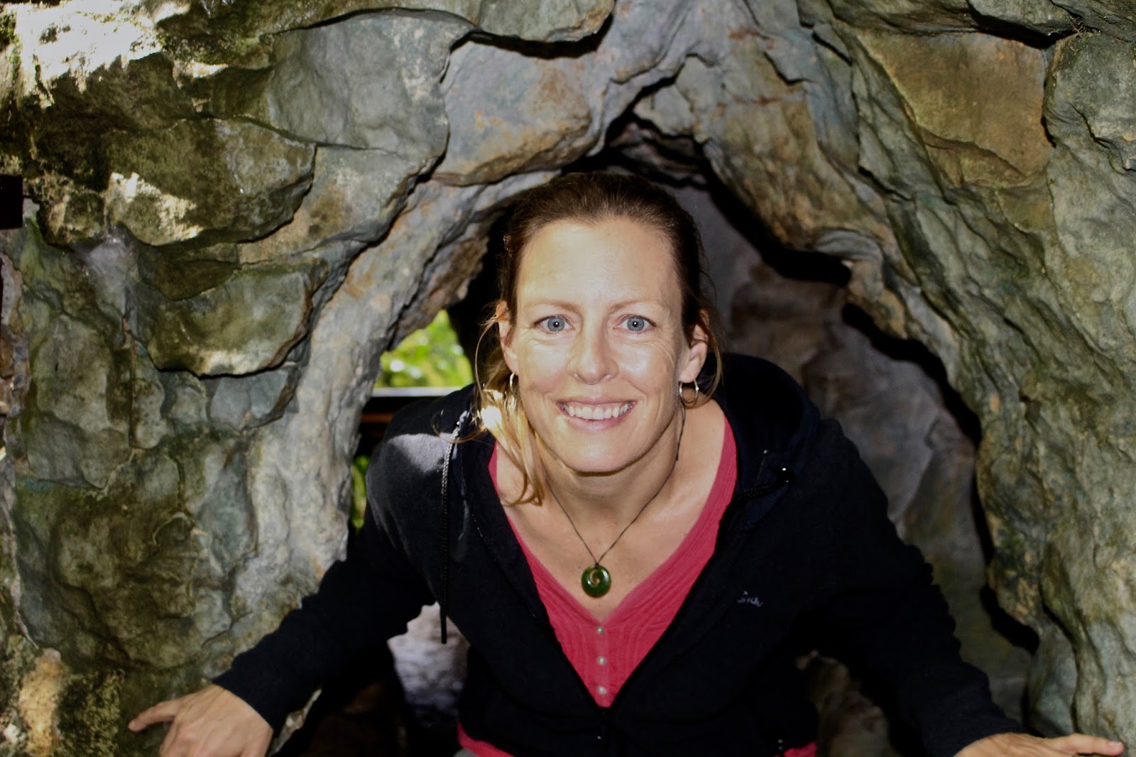
When we planned our big trip to the South Island with both of our parents, we realized that it would be difficult to fit everything in that we wanted to do on such a relatively short trip (you can roll your eyes if you don't exactly feel sad for us that we only had two and a half weeks on the South Island in mid-January : )  So...when we saw an upcoming medical conference in Blenheim in early March, Jen decided to attend, and we tacked on a five day family trip to the one part of the South Island we really wanted to see - the northern part of the South Island, including Nelson, Abel Tasman National Park, and the Marlborough Sounds.

While Kendra had to stay home and work :( the rest of us flew from Wellington to Nelson, which in itself is a great experience.  As an American, we are so used to the lengthy security lines associated with domestic air travel, but in NZ, you show up to these small airports 20 minutes or so prior to departure, walk 50 yards at most to your gate and climb on board your plane.  Sweet As!  Forty short minutes later, we had crossed Cook Strait, landed in the tiny Nelson airport, grabbed our backpacks and were on our way to the rental car company.

The centerpiece of our plan was a four day kayak and backpack trip through Abel Tasman National Park, which  consists of rugged hills overlooking pristine coves of white sand beach and aqua blue water on the very northwestern part of the South Island.  We designed the trip to be able to experience Abel Tasman both from the water, and from the land.  So, the first two days we hired kayaks and paddled northwards on the sea from our starting point of Marahau.  And the last two days we turned in the kayaks and backpacked on foot further north along the famed Abel Tasman Great Walk to the town of Totaranui, some forty kilometer to the north of our starting point.  From there we would be picked up and water taxied back to the start point.

Our first two days were guided by a young woman, Jodi, from the kayak rental company.  Due to Lindsay's age, we were forced to have a guide for the time on the water, but we were ultimately really happy she was with us!  She helped us to stow our belongings, gave us some sea kayaking tips, helped us to take pictures and most importantly,  helped with the cooking and cleaning.  She also charted the course for hidden sea caves, inland tributaries, her favorite desolate beach coves, and to seal colonies on the rocks in the islands dotting the coastline, thereby saving us massive amounts of time if we were exploring on our own. She also befriended our girls which was awesome!

Jodi had us in the water right away, and we kayaked for a couple hours, finding some sea caves that we went in and out of...

...and we finally stopping at Appletree Bay for a snack.  Inland was a clear lagoon, protected by a strip of sand.  Here we are parked at the lagoon, which was filled with warm, swimmable water.

Next up we visited Adele Island, and Hello! we saw a seal colony just off the northern tip of the island.  Then we proceeded to our first night's camp spot, Observation Beach.  This was a really special campsite, accessible only from the water (there are no hiking trails leading to it.)  The site has perhaps six campsites total, a latrine, and a private beach of about 100 meters in length by about 30 meters deep, all surrounded by bush and forest. Here is a picture of us as we approach the campsite from the water.  hopefully this picture conveys how very isolated and awesome this campsite was!

We had the good fortune of camping with a friendly group of guys from Minnesota (!) and...Bruce (!!), the DOC hut warden who had entertained Kendra and Pete when they did the Tongariro Northern Circuit. He and his new fiancee were camping there as well, and everyone communalized their stuff and dinners and drinks.  A fun night of bocce, swimming and picture taking ensued, as we had a stunning sunset.

We woke to a beautiful sunrise...

...and after breakfast, packed up and got back on the water. We kayaked through the "Mad Mile" - the one really open patch of sea (it wasn't that bad actually) - and then explored Boundary Bay, Frenchman Bay and finally Sandfly Bay, where we rested for lunch.  It was stunning, a turquoise lagoon with a river filling it from inland, and the incoming tide of the sea on the other.

After lunch we explored the fresh water river flowing out of the hillside via kayak, seeing eels, hawks, and greenery.  On our way back down the stream we could really feel the tide starting to come in, so it was hard work. We went out into the ocean and to some reefs to see birds and seals.  Here is a typical photo from the water of all four of us, Jen and Lauryn in the foreground, with a small island just in the distance.

Views like these made the hard work of the kayaking much easier!  And just when we thought our arms and backs would give out, we rounded one last corner and saw another cove where our second night's campsite was, at Bark Bay.

We bid farewell to our kayaks and to our guide, and had a great night to ourselves.  Here we are at the campground.

Bark's Bay was a much larger campground, and also there was a hut at the site.  The great walk also runs through it, so this was fairly crowded, but only by Kiwi standards.  It really was a lovely beach campground, with a bay behind it that filled and emptied with the tide.  And, a 10 minute hike away was another secluded cove where we were completely on our own on a tiny sand beach replete with perfect climbing rocks.
Pete even woke at dawn to watch the sunrise, and the feeling he got was anything but crowded - it was just him and the sun and the sea.

Fortunately we had timed the tides perfectly (through sheer luck) and so the next morning, we put on the packs and cut across the dry lagoon (tide was out) and thus cut off about 30 minutes of walking time on our next hike.  We though how nice it was to be out of the kayaks - our shoulder, back and tricep muscles were starting to feel it - until we had backpacked 4 miles and started to realize how heavy the packs were and how nice it was to have them previously stowed and floating in the kayaks.  But, it was great to hike the Trail and see Abel Tasman from a different angle from above the bluffs.  Here was a typical view...

It was with relief that we settled into Awaroa Campground, this time via a very wet hiking "path" (tide was coming in and we got wet!!) Awaroa was a popular destination on the Great Walk, having a hut, a campground, and a lovely lagoon beach at high tide.  However, the dreaded sandflies found us again, and so we donned our head nets, and wore long pants and tops despite the fairly warm conditions.  Lauryn forgot to cover up her ankles however, and within an hour or so, had probably 25 bites!  Curse those sandflies!

The following morning we were up and packed for an early crossing of the lagoon at low tide, thus cutting off over an hours hike around the hills of the lagoon.

Nice!  Another lovely hike through rugged bluffs and along desolate beaches ensued...


Soon we could make out the beach of our final destination, Totaranui.  A profound sense of satisfaction came over us.  Here we are at the end of the track!

And here are two girls who are really happy to have gotten rid of their backpacks, though Lauryn has acquired something just as heavy!

We had done it....but what we didn't know was what an adventure the boat ride would be!  First we had to climb aboard the Water taxi...

...and then we found out that "the sea was angry that day, my friends!"  Anyway, it was one crazy speedboat ride back down the coast, in which we were popping up and down over one and half meter ocean swells.  We stopped once to see a ray swimming in the shallows, but otherwise, Dad kept a death grip on the front side of the boat and tried not to hurl, while the girls got absolutely soaked in the back of the boat.  Finally our boat was met by a tractor that backed into the ocean, and our boat driver jumped out of the boat, hitched our boat up, climbed into the tractor and pulled us all the way back to our car! It was very Kiwi.  

We came into this trip to Abel Tasman with fairly high expectations, but our outing easily topped them. We had heard that it was beautiful but overhyped and crowded. We couldn't disagree more.  The little beaches, the scenery, the challenge... all of that combined for an unforgettable experience, as the pictures can attest.  We loved Abel Tasman park!

We still had a couple days and one night left, however, so next up we drove to French Pass in the very far north in the Marlborough Sounds.  It was unbelievably remote, with very little in the way of civilization.  The land was very rugged - high forested hills mixed with pasture land dotted with sheep, all of it running thousands of feet steeply down to the sea.  The first picture gives an idea of the topography of the area, and the second, the inhabitants : )


We overnighted at a bed and breakfast that was 15 minutes drive from their nearest neighbor!  We had a great dinner and breakfast with the owners and loved the conversation and company. The B and B had their own private beach, some nesting penguins on the property, and lovely gardens.  At night we were so remote that we could make out more stars than we had seen since being in the interior of the South Island. Here is a picture looking down from our cabin on the main house and beach.  And, yes, that is their boat which you could hire if you wanted (but we had had enough of boating!)

What a spot!  In the morning, we drove out the extra ten minutes to French Pass, a tiny strait where the Tasman Sea meets the Pacific Ocean.  The tides make for one of the most dangerous boating areas in the world, as their are times where one side of the strait is roughly 2 meters above the other.  Looking down on the water, it was frothing, and running in one direction like they were white water rapids.  This picture looking down toward the pass (from a lookout some hundred yards above) probably will not do it justice.  But if you ever get out there, you won't be disappointed.

Finally we left and made our way back toward Blenheim, stopping only the once at Elaine Bay, another scenic bay where we saw jellyfish from the pier and marveled at the crystal clear water.

An hour or so later, we had arrived into Blenheim, dropping Jen off for her conference, while the girls and Pete headed for the tiny three-gate airport and their flight back to Wellington. Whew! It was a whirlwind, we were exhausted, but... we were really glad we made this trip!


Monday, April 25, 2016

Wonderful weekend - Wellington, Weta, and Wairarapa

We are really very fortunate to live so close (2.5 hours by car) to Wellington, the capital city of NZ.  We have been down to visit numerous times, and have used it as a transit hub on a few other occasions.  We previously described it as a mini-San Francisco, since it sits geographically on a bay, and has hills with charming residential neighborhoods popping up all over from the city center.  Culturally it feels pretty hip and urban - good restaurants and cafes, museums and sports stadiums, and visible ethnic diversity.  Still, with just over 400,000 people in the urban area, it remains an approachable, safe and cute little city.

Over the long Easter weekend (both Good Friday and Easter Monday are federal and school holidays, so the kids and Jen were off for four days) we decided to make another trip down to Windy Wellington and then also to explore the Wairarapa region in the Southeastern most part of the North Island.  We come away strongly suggesting a long weekend trip to the Wairarapa!

Saturday morning we woke and drove straight to Te Papa, the national museum of NZ.  Every exhibit we have been to at Te Papa has been unbelievable, made more remarkable by the fact that entrance is free!  This time we went back to "Natural Forces" and to some historical exhibits on NZ, and we went to the touring exhibit by DreamWorks.  We really enjoyed the way DreamWorks walked us from their initial film concepts and through to the final production of the movie.  It really made us appreciate how much thought, time and creativity goes into making the movies that we enjoy and are part of our families collective experience.  Here is Lindsay doing a little Kung Fu Panda!
Leaving Te Papa, we drove to Miramar, a suburb of Wellington, and to the Weta Workshop, also known as the Weta Cave.  This was another of our geeky must-do Lord of the Rings related visits.  Weta Workshop is a small special effects and props workshop that movie studios use for their movies.  And their huge claim to fame, or break-out moment came when Peter Jackson (Lord of the Rings director) came to them to do the props and effects for the LOTR trilogy back in the late 1990's.  (Subsequently, they have done the props and effects for Avatar, Narnia, the Hobbit trilogy and now are working on more Avatar sequels.)  Here are the girls out front of the studio with a troll.

Arriving at the Workshop for the Tour, we were first amazed at how tiny of a company this appears to be.  Despite its worldwide notoriety and regard, it is still just a small enterprise operating out of a warehouse with adjoining studios.  Most of the people working there are contractors, not employees, signing on for short term gigs.  The sense we got from our limited interactions with those contractors on the tour is that working for Weta is comparable to working for google or apple among techie geeks - this is the top spot for set or costume design.

We did the hour long tour and movie to follow and came away with yet more appreciation for how much detail goes into movie making, specially the Lord of the Rings movies.  The number of sword designs that the company went though, for instance, in coming to a final set piece for Gandalf's sword or the Orc swords, is remarkable.  Ditto for mask and costume design.

Our favorite stories we gleamed on the tour were about the sword that Aragorn used, the fact that it was real, and that he actually carried it around Wellington while filming (with a permit and note of explanation for the police) - all because he used a real-life weighted sword for his battle scenes.  And the story of the scene at Helm's Deep where Aragorn tosses Gimli was explained - the dwarf he tossed was actually a foam and rubber dummy and if you watch the split second shot in the movie you can apparently just make out that the Gimli's arms bend rather unnaturally while he is being tossed : )

Back in the car, we then drove almost two hours out of town, up and around Lower Hutt and to the Wairarapa, an area of wineries, farms, coastline and some awesome natural wonders.  We camped two nights at this quiet DOC site at Putangirua Pinnacles.  Here are our lovely little girls setting up camp.

The Pinnacles themselves are a sort of "badlands" of eroded pillars, or pinnacles, that have formed as an ancient sea bed is carved out by rainfall.  The area actually became a filming location for LOTR in the third movie, Return of the King.  From the DOC website...
"The eerie scenes in The Return of the King as Aragorn, Legolas and Gimli ride along the Dimholt Road to meet the Army of the Dead were filmed against the surreal backdrop of the Pinnacles."
There were some pretty interesting formations just an hours hike from the camp site.  We did this walk in the morning and Jen got some pics of the formations. This picture doesn't quite give a great sense of the height and massiveness of these pillars, which were easily over a hundred feel tall.

After the hike, we drove down to Cape Palliser and the southernmost tip of the North Island.  We climbed the 251 steps from the carpark up to the Lighthouse to gaze down at the beach and toward the South Island, which was clearly visible (though barely in this photo here.)
Thats a lot of steps....
The Lighthouse, which was built in 1897, and was lighted by oil until the 1950s, completed a North Island journey of sorts for us - we have now been to Cape Reinga on the very northern tip, and to Cape Palliser on the very southern tip.
On our way back toward the campsite, we stopped at a rocky beach to view a seal colony.  First we took a cute shot of Jen holding the lighthouse in her palm (get some perspective, people!)

While Jen and Pete watched a large number of pups playing together in a tide pool, the girls did some rock climbing to get a birds eye view of the entire beach (also because they knew it would be smart to occupy themselves since Jen has generally been reluctant to tear herself away from taking pictures of baby seals.)

Finally the girls walked back down to where we were, and then Lauryn got a great surprise.  Walking on top of a rock, she heard a very LOUD growl, and shrieked in a bit of terror.  She had walked on top of a rock under which a pup was resting. Very funny to us.  A little scary to her.

Here are two cute pics of the seals - the first of some pups at play on the rocks above the frothing surf.
And then this one was of this curious little pup who was just swimming in yoga-like positions in the tidal pool.  He (she?) was very entertaining, and kept it up for 15 or so minutes.  This looked a bit like a seal version of triangle pose, as he/she is holding her front and back fins together.

After peeling Jen away, we went back to the campsite for a great time playing bocce, and an excellent campsite dinner. Jen and Pete set out for another hike to see the Pinnacles by dusk, but realized that we would miss the actual sunset there and that it would be dark by the time we arrived.  But all was not lost...on our way back to the campsite we had great views out to the ocean, and Jen got this great photo walking out of the Pinnacles, with the sun setting over the Pacific.

A rough night of sleep followed, interrupted as it was by a fierce wind storm in the middle of the night.  Amazed that our tents withstood the gales (our neighbor was not so fortunate - we heard a horrible ripping sound in the middle of the night, followed by cursing and moving of tents), we packed back up in the morning and took off for one more adventure in the area - the Patuna Chasm Walk in the Ruakokopatuna valley of the Wairarapa.  We did not plan this one all that well, thinking it was just a short walk off the road.   It was much more of an adventure than that - and well worth it!  From the website..."The famous Patuna Chasm is a two kilometer long labyrinth of towering limestone caverns and tunnels." The chasm is located on private land, so first we drove to a farm and we were led by the farmer (at high speeds) by car on dirt roads to a parking spot. From there the hike and adventure began, with ominous signs telling us that we were in for a "four hour walk" and some lessons in flexibility to our day planning. After a long tramp through sheep and cattle pastures, we entered the chasm via a series of ladders, ropes and scrambling.

And, finally, we were down in the Patuna Chasm, in ankle to knee deep running water.  The limestone walls surrounding us ranged from 30 to 100 feet deep in spots, and would occasionally narrow and get darker, almost as if we were in a tunnel.  Here is a picture of Lindsay and Lauryn in the deepest part of the chasm.
And here is Jen doing her best to stay warm!
Our first actual destination in the chasm was a beautiful waterfall that cascaded down the moss covered walls.  It was stunning.
After the waterfall, we walked downstream for an hour or so through varying caverns and tunnel-like structures, occasionally scrambling with the use of ladders and ropes to stay relatively dry (these were built into the rocks where the river would perhaps get to chest height.)


At one point we realized we were in "eel-infested waters", but these were not the shrieking eels of "Princess Bride" fame.  Rather they were HUGE but harmless river eels that looked to be a lot more wary of us than we were of them : )
The river and the rocks were slippery and made for a real challenge, so we were really beat when we got back out.  Here is a beautiful picture that Jen took of the river running over the slick rocks.

What a cool hike - if you ever get to the Wairarapa, this would be high on our list of recommended things to do!